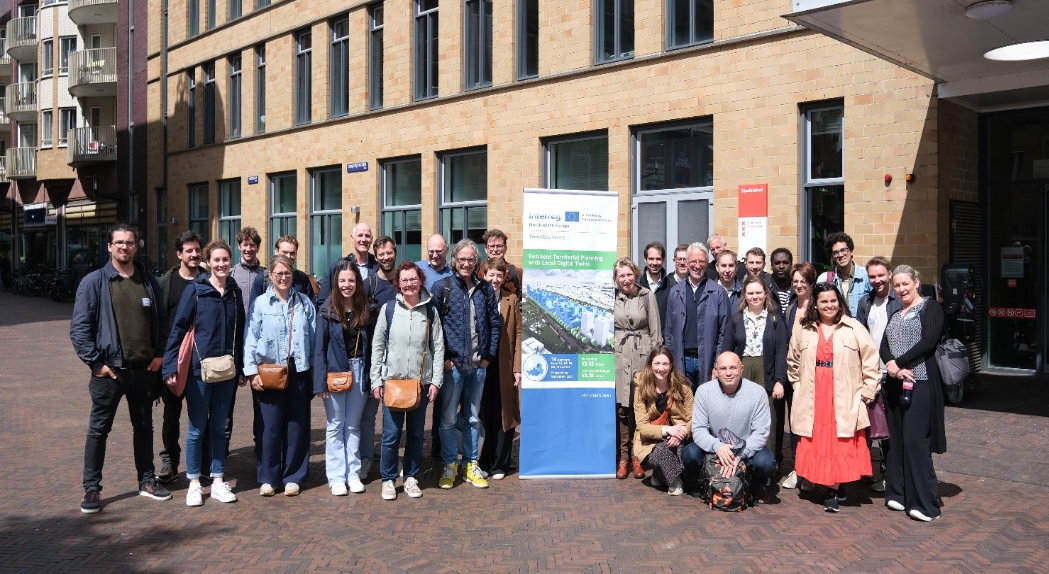
Dublin City Council joins the Interreg Twin-4-Resilience Project as a Pilot Partner.
This project will explore the use of Local Digital Twins for a wide variety of applications in urban areas. It is in collaboration with 14 European countries, 8 of which will pilot projects and it will run for a 36-month duration.
In the green and digital transition, public local authorities face an increasingly complex decision-making environment in territorial planning. To achieve resilience, they need to systematically innovate with new ways of working which are creative, inclusive and affordable. Local Digital Twins (LDTs) can be an important building block in this journey towards systemic innovation.In very simple terms, LDTs are digital representations of a territory, e.g. a city, created by modelling and simulation technology, based on datasets and models. LDTs can visualise, analyse and simulate territories in a way that could not be done before, integrating datasets of different stakeholders simultaneously in a 2D/3D geo-coded virtual environment.
Many cities across Europe are already experimenting with LDTs, but their characteristics and maturity differ widely. Development and deployment are usually hindered by a lack of understanding of what an LDT is, what are its basic functionalities, how can they future-proof our cities and how can we ethically deploy them.
The Twin4Resilience (T4R) project is an opportunity to move a little bit away from technology-driven solutions and rather focus on increasing people’s and organization’s capacity to ensure wider uptake of LDTs for high-impact city applications. It brings together 14 partners from 6 countries, to jointly deliver a resilient implementation strategy and pilot in a real-world setting adopting 4 transformation frameworks – technical design, governance, ethics/inclusion/democratisation, and training. The project runs 42 months starting 23 November 2023, supported by INTERREG North-West Europe co-funding.
DCC Digital Twins
Different departments of Dublin City Council (DCC) have been experimenting with state-of-the-art 3D modelling technologies such as drones, building information models and LIDAR scanners for surveying, mapping, and data collection. This data is further being used for planning across various thematic challenges such as energy consumption, urban planning, public engagement, environment, tourism, and infrastructure management to support its vision for a dynamic, sustainable city, that is future-ready, built on thriving, inclusive neighbourhoods, and communities, a strong economy, a vibrant cultural life, and compact, connected growth (Dublin City Council, 2020).
Smart Dublin, founded by the four Dublin Local Authorities, brings together technology providers, academia and citizens to transform public services and enhance the quality of life by trialling and scaling innovative solutions to a wide range of local challenges. It also realises a massive opportunity to leverage LDT technology for improving communication with its key stakeholders and communities on future projects and investments planned for the city.
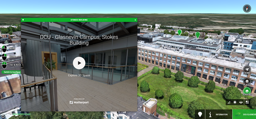
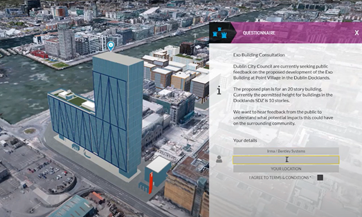
In 2019, a 3D Hackathon was organised (120+ participants) by DCC, uncovering new insights into the potential of 3D models for city planning. It resulted in many innovative applications and ideas from the industry and academia. DCC through its Smart City programme also established an innovation partnership with Bentley Systems to explore the potential of using digital twins to support public engagement for future city proposals during the COVID-19 pandemic. A digital twin in this context is a virtual representation of a physical place – so buildings, streets and assets are all digitised into a 3D virtual environment allowing the data to be visualised interactively. This work was initially centred around the Smart Docklands district where a prototype 3D model and engagement interface were developed in 2020 using Open Cities Planner. The model is being experimented with using gaming engines and immersive solutions for an interactive user experience for the community. The partnership with Bentley Systems was further extended to demonstrate the potential of campus digital twins using the Smart DCU sandbox environment and Dublin Fire Brigade for its pre-incident planning and emergency response use cases.
Our Objectives
Dublin City Council aims to showcase the value of LDT as a visual tool which can integrate diverse datasets in a unified geospatial platform and able to communicate relevant data insights to key decision-makers, local stakeholders and communities. The wider uptake of LDTs for territorial planning and training of local authority staff will ensure a smoother digital transformation within the organization.
Its well-placed smart district collaborative programme and long-standing partnerships with Industry and academia contribute to the research and technical expertise needed for LDT design. The LDT frameworks and resilient pilot action expect to provide lessons and build local capacities within the organization to adopt digital technology for good.
Being active in EUROCITIES network, Bloomberg Philanthropies, Harvard Tech City Innovators Forum, Cities Today Institute, the European Commission’s Mission for 100 climate-neutral and smart cities, Lving-in.EU, and UN’s Cities Coalition for Digital Rights, DCC will contribute substantially to disseminating project results at multiple forums. Dublin’s local stakeholder group comprises four DLAs in the region under the Smart Dublin umbrella, not-for-profit professional institutions, local communities, researchers, universities, SMEs etc. T4R will bring awareness to the use of LDTs for territorial planning and data-informed decision-making.
Resilient Pilot Actions
The city’s climate action plan is at the core of its proposed pilot action forging a better understanding of the value of new proposals for resilient territorial planning. The first use case focuses on a multi-thematic 4-dimensional planning experience for everyone to visualize the spatial transformation of the city’s historic Docklands area to a strategic development zone over the last few decades and further overlaid with future scenarios in baseline urban settings as outlined under the climate action plan. On the contrary, the second use case will try to highlight the value of ongoing active travel investments on a city-wide scale with a possibility to further narrow down to one of its key walking and cycling project schemes focussing on the wider objectives of population well-being and environmental impact.
To learn more about his project visit https://t4r.nweurope.eu/