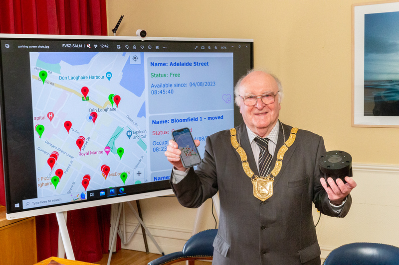
Dún Laoghaire Rathdown County Council (DLR) has launched a new accessible parking app ‘dlr Spacefinder’ to help disabled drivers locate available accessible parking spaces using real-time information.
This new app is a direct response to challenges surrounding accessible parking. The primary objective of the app is to streamline the parking process and allow Blue Badge users to more easily navigate the town.
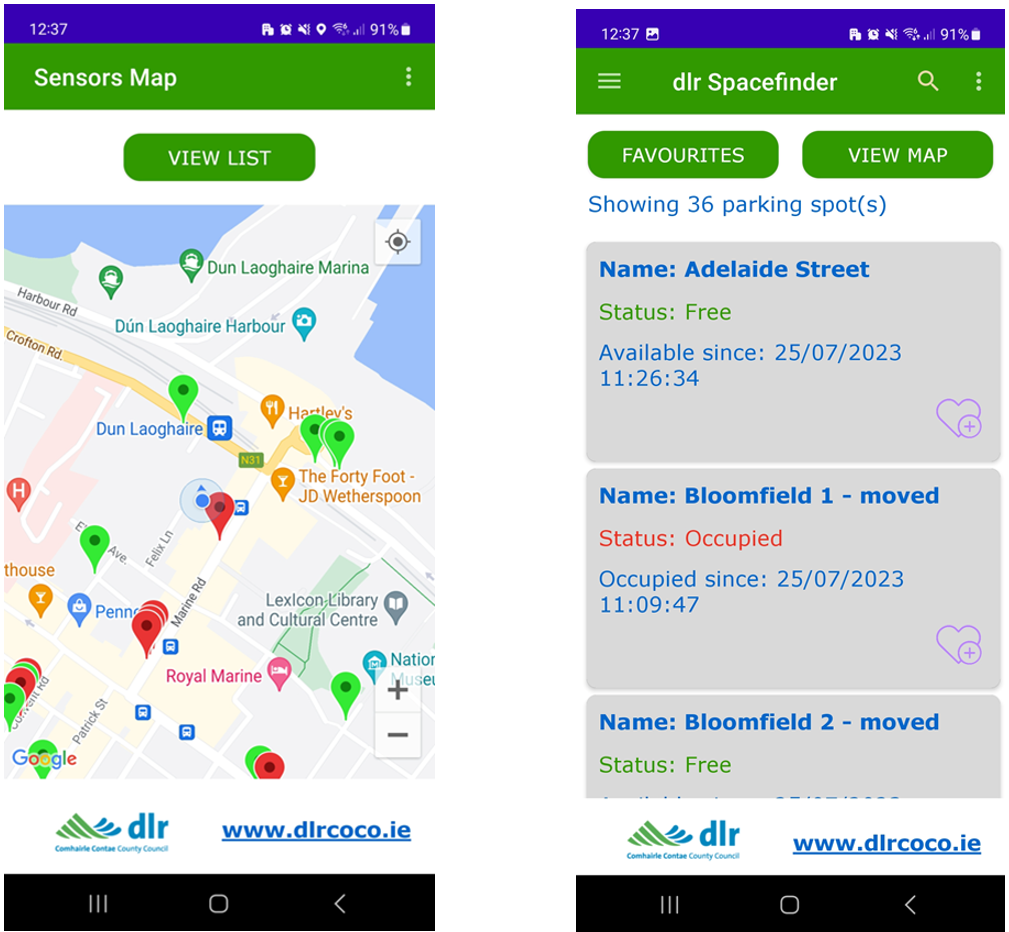
The app is available to download on the Apple and Google Play store as ‘dlr Spacefinder’.
The real time data is enabled by sensors installed in 37 accessible parking bays in Dún Laoghaire, which will provide live data on available parking spaces. The data generated can be consumed by a number of organisations including Access Earth and the Disabled Drivers Association of Ireland on their own app “DDAI Spacefinder”
Relevant data will also be published as open data to provide further value.
Councillor Denis O’Callaghan, An Cathaoirleach at DLR said “There is a continuing perception that parking in Dun Laoghaire is problematic and often this perception is worsened through a lack of information. In this instance, we are getting very focused information out to a targeted and deserving group to ensure access to Dún Laoghaire Town is equitable and a hassle free experience”
Frank Curran, Chief Executive at DLR said “Increasingly Local Authorities are looking to emergent technology to help meet everyday challenges. In this case the data generated is useful not just to us but to other third parties such as the Disabled Drivers Association of Ireland and Access Earth. Through our Digital Strategy Team we intend to roll out further solutions and look forward to strengthening the relationship with our partners”
The app has been developed in collaboration with Cellnex and Parkmagic.